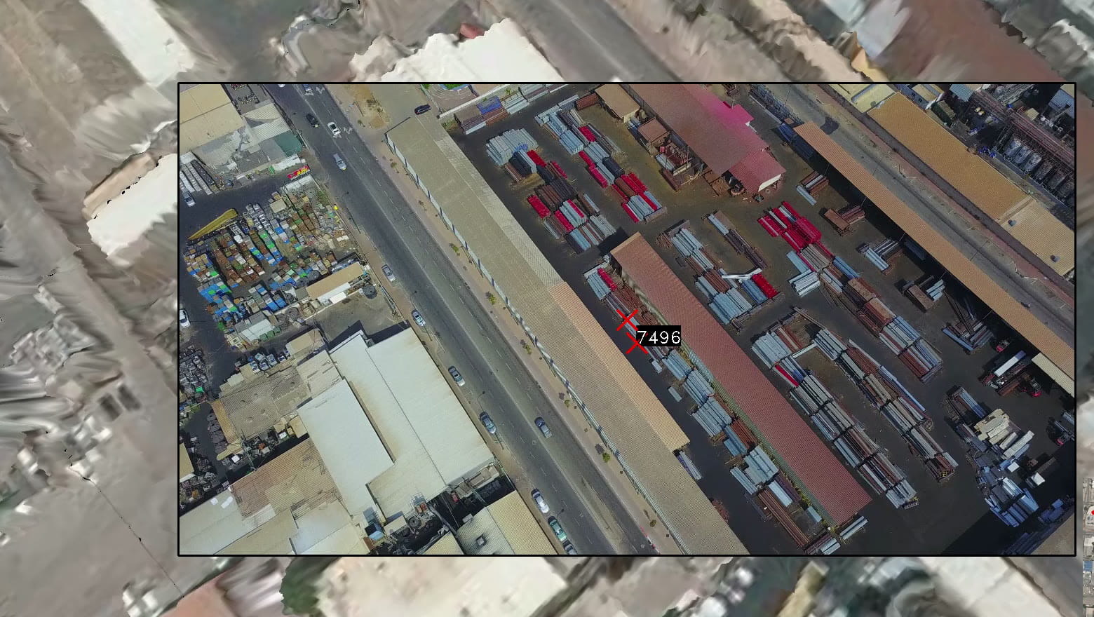
GPS and compass aren’t enough
GPS has availability and accuracy gaps, and a compass isn’t always accurate, with a deviation of 5-10°. The result: no way to get an accurate coordinate from a distance.

Real-time aerial video localization
Precision Navigation & Targeting Software layer for drones and loitering munitions operating in GNSS-denied environments.
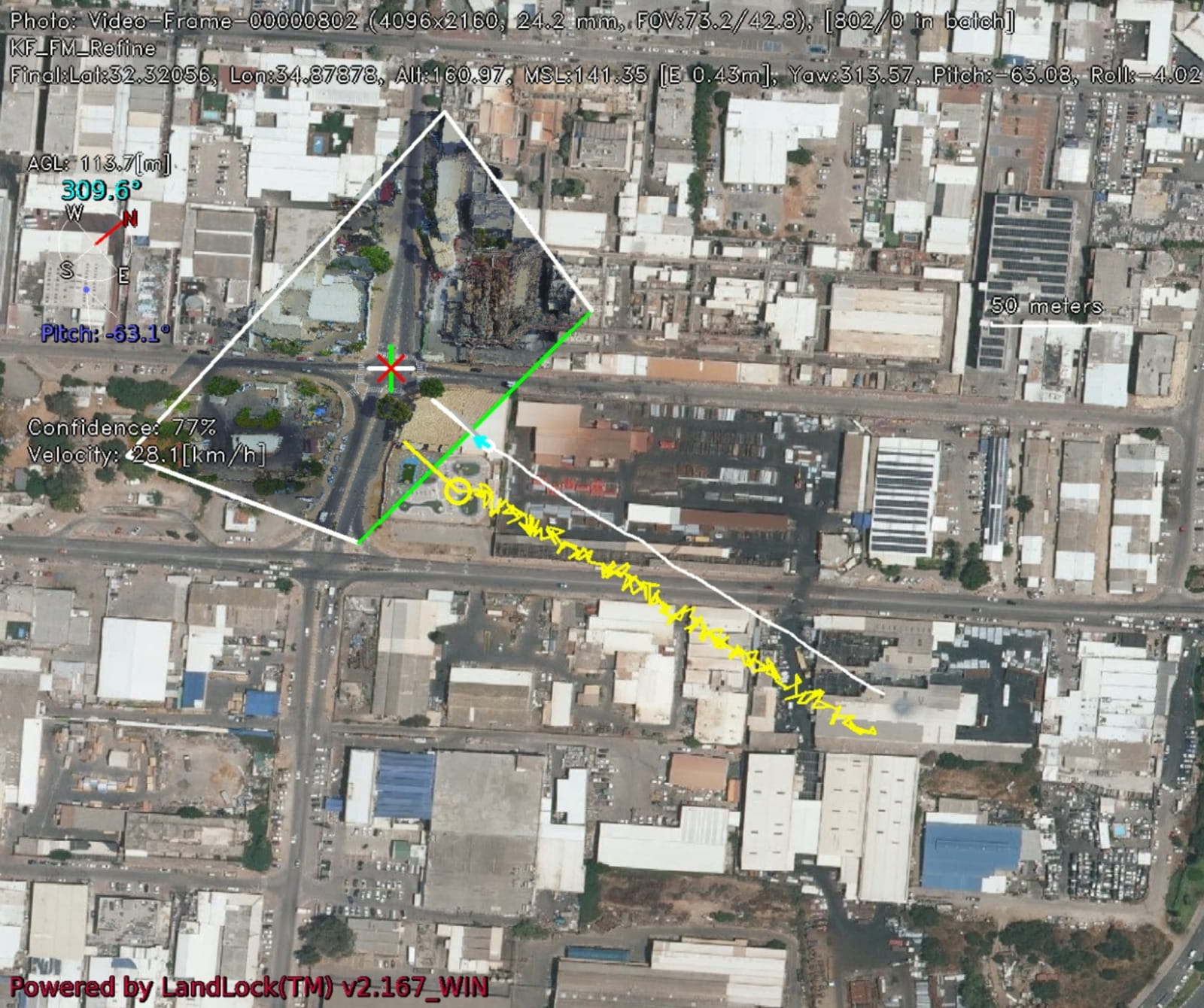
LandLock™ uses AI-driven image analysis of the standard forward-looking camera to provide precise 6-DoF localization and real-time target geolocation - without GPS and without dedicated hardware.
From camera to coordinates
Drones that rely on GPS are vulnerable to signal degradation, spoofing or complete denial - especially in contested or cluttered environments.
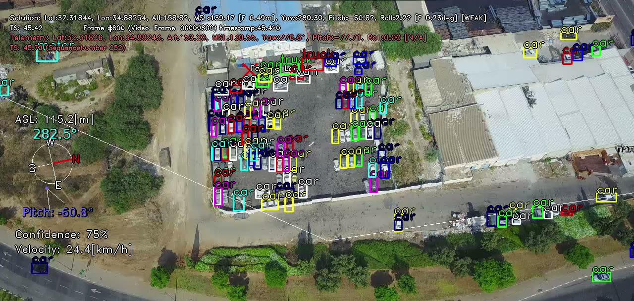
The scan never waited for GPS to fail. LandLock™ analyzes the live video continuously, with or without GPS - from the standard forward-looking camera, wide-angle or narrow field of view, RGB or IR. No dedicated hardware.
AI-driven image analysis (from any camera) of the video provides real-time (streamed) at 30 FPS.
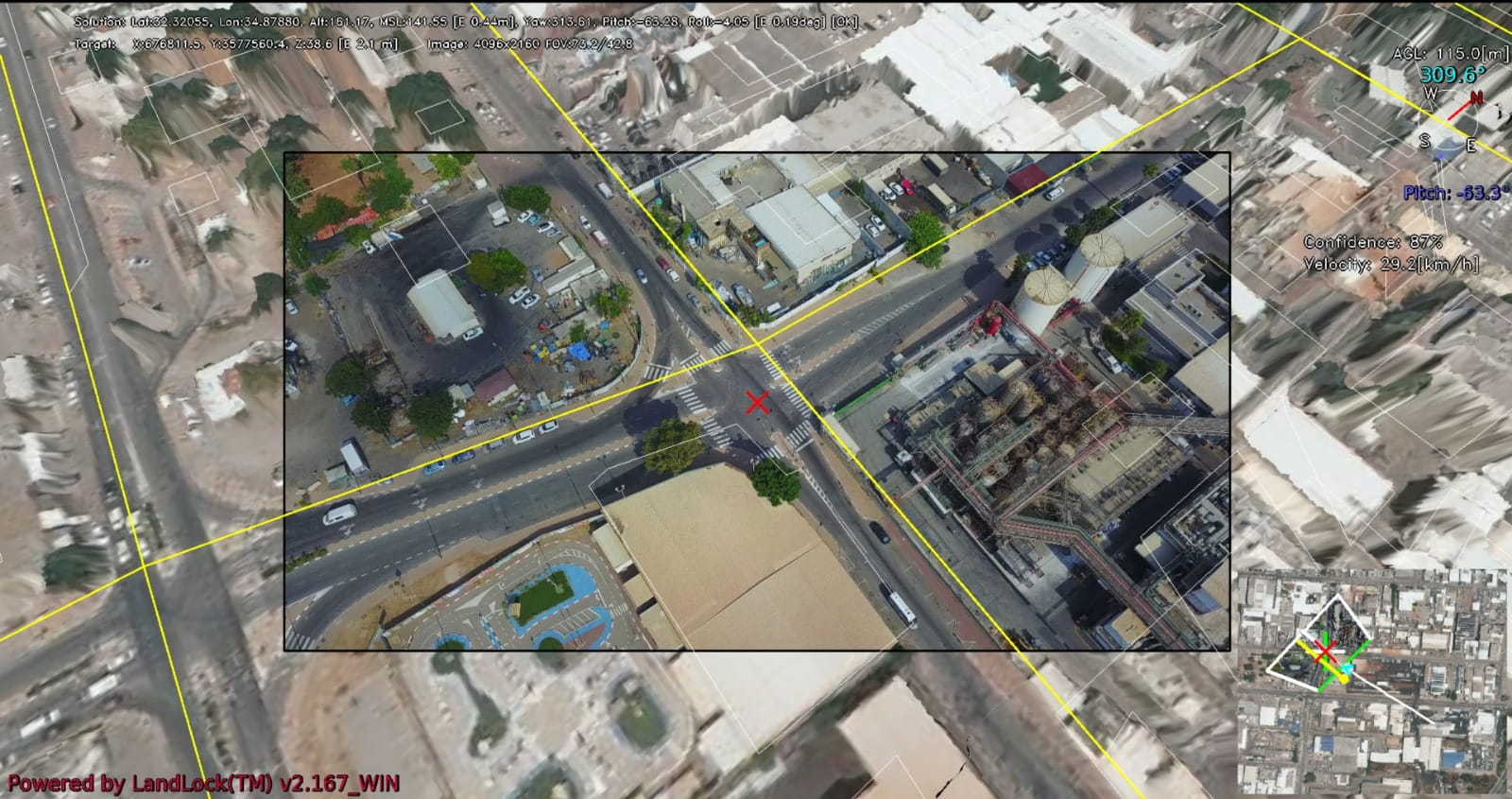
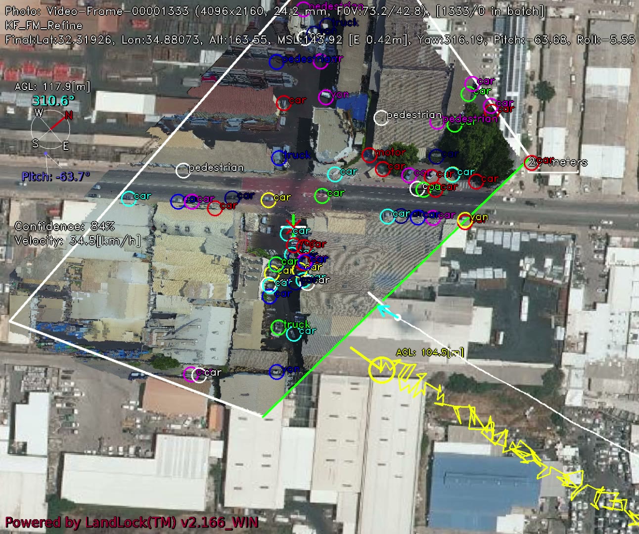
What the camera sees is matched to a geo-referenced map, then tracked continuously and relocked to terrain and map to limit drift.
Precise 6-DoF localization: continuous, sub-meter level positioning of the drone - and any point in the image translates into a ground coordinate.
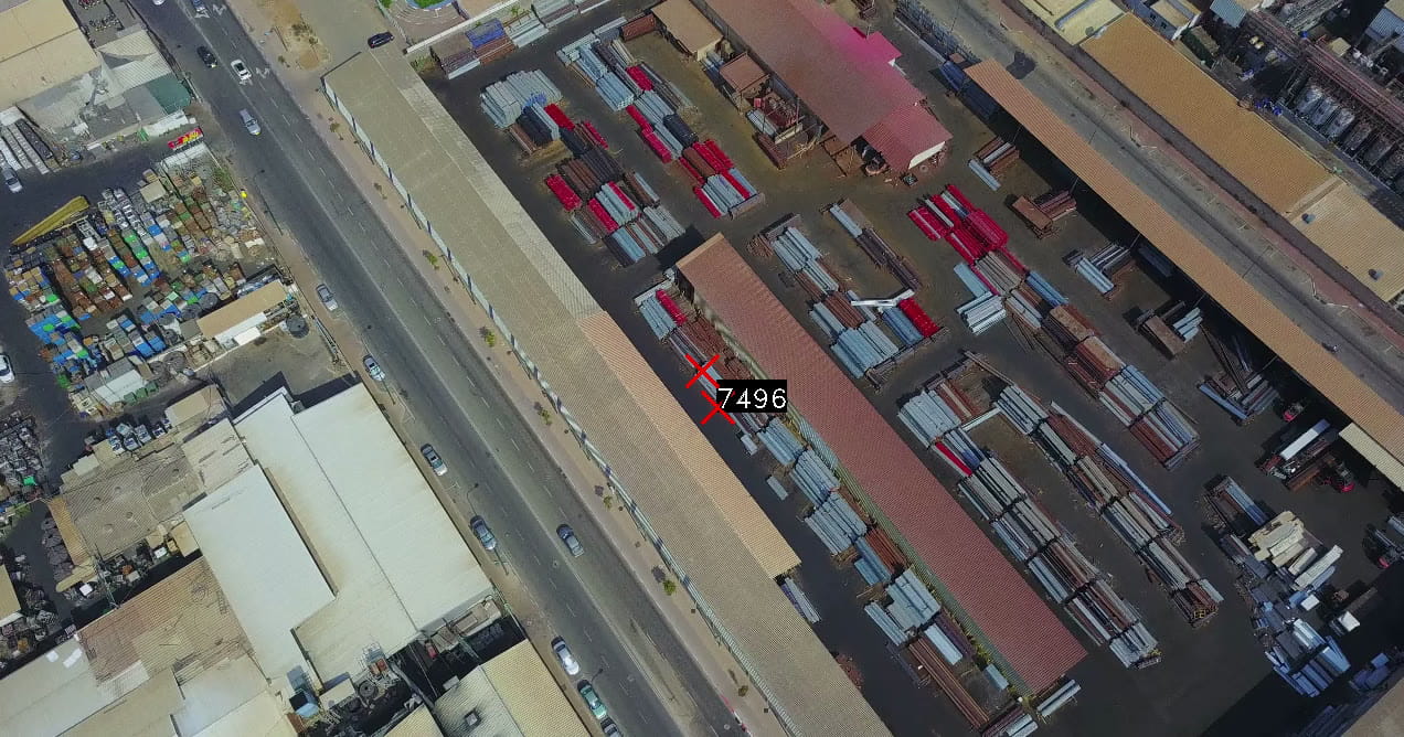
Field footage · camera to map
The problem
Unmanned aerial systems often rely heavily on GPS for localization, making them vulnerable to signal degradation, spoofing, or complete denial - especially in contested or cluttered environments.
GPS has availability and accuracy gaps, and a compass isn’t always accurate, with a deviation of 5-10°. The result: no way to get an accurate coordinate from a distance.
Visual localization solutions struggle with fast, low flight where cameras look ahead to the region of interest. Others require additional hardware or produce unreliable coordinates.
A manual operator bottleneck reduces operational effectiveness, constrains mission execution, and leads to losses through failed missions, missed targets, and lost systems.
Our solution
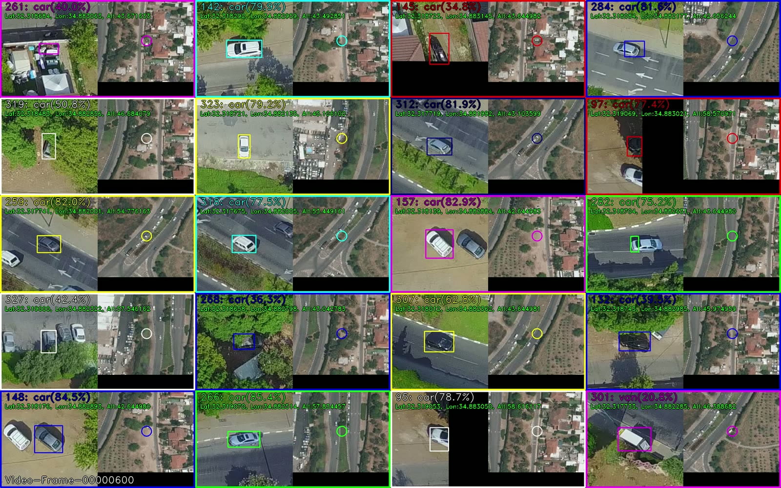
A field-proven software solution for real-time, GPS-independent geospatial localization of unmanned aerial systems. It provides continuous, sub-meter level positioning of the drone platform while simultaneously generating accurate georeferencing for all detected objects within the video stream.
Match what the forward camera sees to a geo-referenced map to provide precise positioning.
Track continuously and relock to terrain and map to limit drift - stable geo over time.
Translate a point in the image into a ground coordinate instantly, and overlay map information on the live video.
Capabilities
Key features
Real-time 30 FPS localization with modest compute requirements.
From wide-angle to narrow field of view, RGB or IR - works seamlessly with any camera.
Builds high-accuracy orthophotos in real time from live video or still imagery - no post-mission processing or external photogrammetry tools.
Handles separate images with high initial location uncertainty - robust localization even in challenging scenarios such as GPS jamming.
Deploys as a standalone product or SDK, packaged for fast integration (container + APIs) and rapid deployment across existing fleets.
Reduces weight and power consumption - directly extending flight range and endurance - and reduces costs.
The LandLock™ advantage
GPS has availability and accuracy gaps; a compass can deviate by 5-10°.
Removes the dependence on GPS and compass - navigation and accurate coordinate extraction.
Difficulty anchoring horizontal video and handling variable zoom.
Works with any FOV and camera angles.
Price and rigidity of hardware and software products.
Easy & flexible software solution with integration to any hardware.
Target markets
Designed to serve a wide spectrum of mission-critical and commercial applications.
Contact
Interested in LandLock™? Tell us about your platform and mission, and our team will get back to you.